
03 Middlesbrough to Dundee

This route was brought to you by:
RouteXpert Nick Carthew - (MRA Master)
Last edit: 19-02-2026
 Route Summary
 A journey through the beautiful countryside and coast of east England and up into Scotland. Including the Tees Newport Bridge, a vertical-lift bridge, The Angel of the North, Bamburgh Castle, the spiritual Holy Island of Lindisfarne and then across the border into Scotland. The Holy Island is accessed across a tidal road and a knowledge of tide times is crucial, a link for tide times is provided in review below.
The route has earned 4⭐⭐⭐⭐ stars from me because of the scenery and attractions despite many miles on fast roads. Using the fast roads allows time to visit these attractions.
 Share this route


Animation

Verdict


Duration
7h 8m

Mode of travel
Car or motorcycle

Distance
379.02 km

Countries

 RouteXpert Review
 The route uses the A19 dual carriageway to travel north, it's a fast road but quite pleasant to use and in less than an hour from the bridge you'll be at the giant 'Angel of the North' art installation. Since spreading its wings in February 1998, Antony Gormley's The Angel of the North has become one of the most talked about pieces of public art ever produced.
Rising 20 metres from the earth near the A1 in Gateshead, the Angel dominates the skyline, dwarfing all those who come to see it. Made from 200 tonnes of steel, it has a wingspan of 54 metres and a red-brown colour that comes from the weathering steel which can withstand winds of more than 100 miles per hour. Getting up close and personal with the Angel is an experience you'll never forget! There is often a coffee van parked in the car park.
Joining another fast dual carriageway road to leave Newcastle, you can take a short detour to see a small section of Hadrian's Wall . Hadrian’s Wall was the north-west frontier of the Roman empire for nearly 300 years. It was built by the Roman army on the orders of the emperor Hadrian following his visit to Britain in AD 122. At 73 miles (80 Roman miles) long, it crossed northern Britain from Wallsend on the River Tyne in the east to Bowness-on-Solway in the west. The most famous of all the frontiers of the Roman empire, Hadrian’s Wall was made a World Heritage Site in 1987.
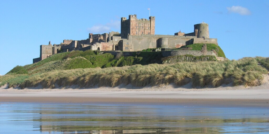
The route leaves the A1 briefly for a view of the Farne Islands and Bamburgh Castle. With its origins in the Anglo-Saxon period, Bamburgh Castle has dominated its volcanic outcrop and the surrounding countryside for centuries. From its humble wooden palisade to the impressive stone walls of today it strikes an iconic pose on the Northumbrian coastline. Open all year round it welcomes visitors to enjoy the grounds and staterooms.
Back onto the A1 again for a short ride to the jewel in the crown of this route, the Holy Island of Lindisfarne. Just a few miles south of the border with Scotland. The island is linked to the mainland by a tidal causeway which twice a day is covered by the tide. Possibly the holiest site of Anglo-Saxon England, Lindisfarne was founded by St. Aidan, an Irish monk, who came from Iona the centre of Christianity in Scotland. St Aidan converted Northumbria to Christianity at the invitation of its king, Oswald. St. Aidan founded Lindisfarne Monastery on Holy Island in 635, becoming its first Abbot and Bishop.
The tidal causeway not only becomes covered twice a day, but it can be slippery and those using two wheels need to be cautious. The island is a thriving community, with a busy harbour, shops, hotels and inns. There is much to see on the island and although a return trip to the centre is only a 15 minute ride, I would advise you to stay a while and enjoy the beauty and history, whether you have religion or not. Check the tide times in the link below. Ever since 635, when King Oswald gave the Holy Island of Lindisfarne to St. Aidan to establish his monastery, the island has been a place of pilgrimage. The road was not constructed until 1954 and until then the vertical poles were the only indicators of the safe route between the mainland and island. The sight of the poles stretching across the sand and mud is one of the most iconic views in Northumberland.
Rejoin the A1, again briefly as the route passes through Berwick-upon-Tweed by crossing over the River Tweed on the Royal Tweed Bridge that runs alongside the lovely old stone bridge. Berwick-upon-Tweed is a facinating English border town just 2.5 miles south of Scotland, renowned for its 13-time change of ownership between the two nations before becoming definitively English in 1482. Berwick Barracks built between 1719–1721, are among England's earliest purpose-built military barracks and stand as a testament to the fighting that took place here. It is the northernmost town in England, featuring remarkably preserved Elizabethan walls, three major bridges, a Scottish-league football team, and a temperate, cool coastal climate.
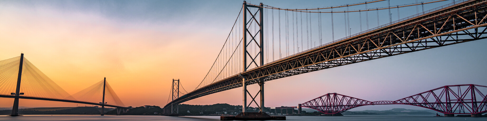
Follow the A1 again and cross the Scottish border and then onto the Queensferry Crossing bridge to the east of Edinburgh. The Queensferry Crossing opened to traffic on 30 August 2017. The 1.7 miles (2.7km) structure is the longest three-tower, cable-stayed bridge in the world and also by far the largest to feature cables which cross mid-span. This innovative design provides extra strength and stiffness, allowing the towers and the deck to be more slender and elegant. As you cross over the Firth of Forth you'll see the Forth Road Bridge and the iconic red Forth Rail Bridge
From here, it's an hours ride through some really nice countryside to the River Tay. The Premier Inn Hotel at Dundee is the end of the route and situated on the north bank of the River Tay. This is reached by using the unspectacular but long 1.3 mile (2.1 km) Tay Road Bridge. The hotel is next to the Royal Research Ship Discovery and Discovery Point. Discovery Point is home to RRS Discovery, a barque-rigged auxiliary steamship built in Dundee for Antarctic research. Launched in 1901, she was the last traditional wooden three-masted ship to be built in the United Kingdom. Her first mission was the British National Antarctic Expedition, carrying Robert Falcon Scott and Ernest Shackleton on their first, and highly successful, journey to the Antarctic, known as the Discovery Expedition.
This award-winning visitor attraction tells the story of the iconic ship ‘Discovery’ from her beginnings in Dundee, her amazing Antarctic expedition with Captain Scott and her voyages thereafter. I would suggest 2 nights in the hotel to allow you to visit this attraction and perhaps a short ride up the coast to Arbroath to sample some Arbroath Smokies from where they are made. No visit to East Scotland is complete without a visit to Arbroath and the chance to eat Arbroath Smokies in this fishing town. These haddock are salt-dried and hot-smoked. They can be eaten cold or warm or used in a variety of recipes employing smoked fish. The Arboath Smokie has a pronounced smoke aroma, as well as a smoked flavor, almost sweet, with a bit of salt. The outside of the fish is dry while the flesh is cream-coloured, moist, and flaky. Aficionados say the flavor has more depth than other types of smoked haddock. I have added a POI to the map for The Old Boatyard Restaurant in Arbroath.
Enjoy

 Links
Links  Usage
Usage Want to download this route?
You can download the route for free without MyRoute-app account. To do so, open the route and click 'save as'. Want to edit this route?
No problem, start by opening the route. Follow the tutorial and create your personal MyRoute-app account. After registration, your trial starts automatically.  Disclaimer
Use of this GPS route is at your own expense and risk. The route has been carefully composed and checked by a MyRoute-app accredited RouteXpert for use on TomTom, Garmin and MyRoute-app Navigation.
Changes may nevertheless have occurred due to changed circumstances, road diversions or seasonal closures. We therefore recommend checking each route before use.
Preferably use the route track in your navigation system. More information about the use of MyRoute-app can be found on the website under 'Community' or 'Academy'.