TTT 2015 04 Slenaken Prum Slenaken

This route was brought to you by:
RouteXpert Hans van de Ven (Mr.MRA)
Last edit: 26-12-2019
 Route Summary
 The 173 ANWB Promoter TankTasTocht (TTT) were scanned by Henry ten Dam and signed by Leon Stolk in Mapsource and later placed as a Track in a .gpx file. These are made available through the MrGPS website with the approval of the ANWB Promoter so that everyone can enjoy them. The 1st TTT is from 1992, so the route may differ slightly from the original.
I have checked all route points and, where necessary, placed them neatly on the road. Also, if necessary, I have further spaced the start point and end point of the route to avoid navigating directly to the end point and I added the POI files from the start and end point just like a possible stopping point.
Finally, I made the route the same for TomTom, Garmin and MyRoute-app Navigation users.
Thanks to Henry, Leon, MrGPS and Promoter.
 Share this route


Animation

Verdict


Duration
5h 39m

Mode of travel
Car or motorcycle

Distance
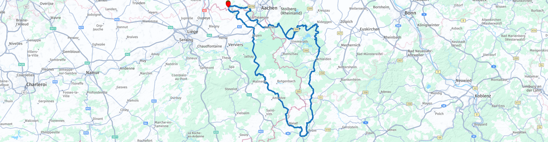
273.01 km

Countries


 RouteXpert Review
 Pretty soon after the start you are on the Eperbaan, a beautiful steering road with some very beautiful curves. After passing the 3-country point you drive into Belgium, after a few nice curves and some small places you drive into the Eifel.
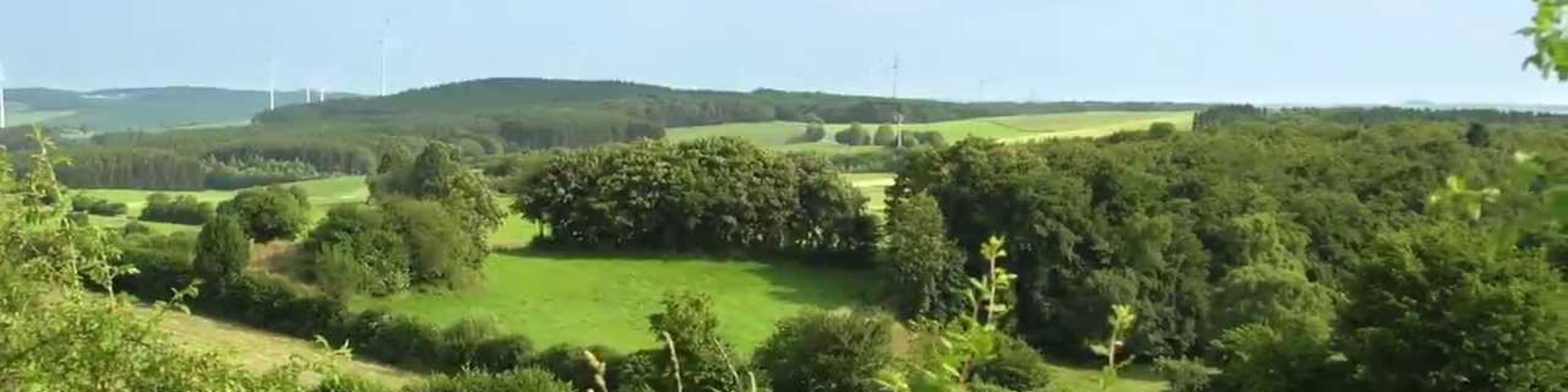
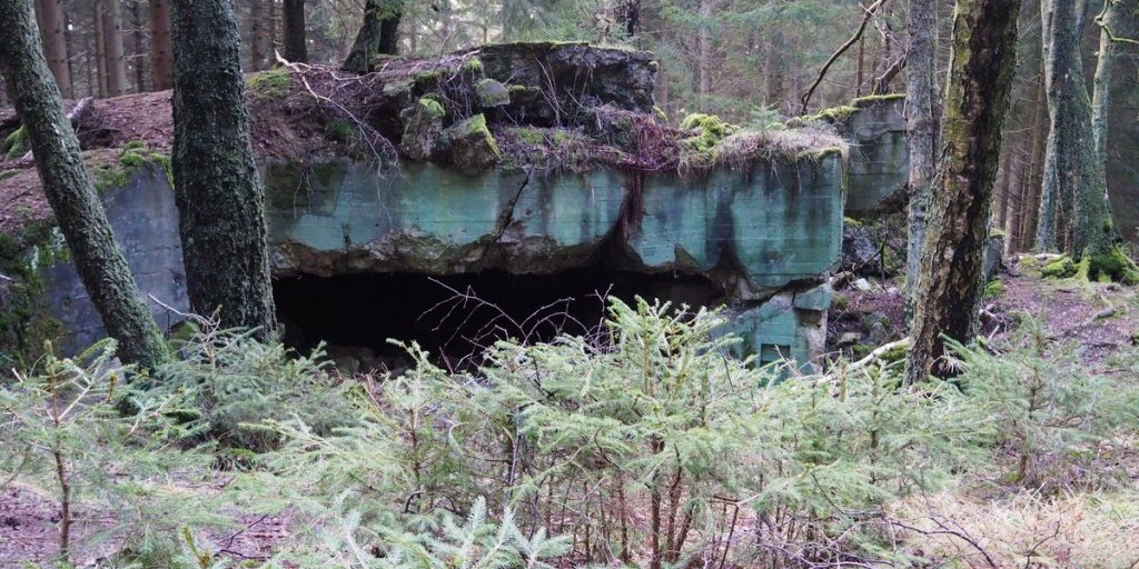
The Eifel is the eastern part of the middle-high plateau of the Eifel-Ardennes. It lies north of the Moselle and west of the Rhine. The largest part is in Germany, a small part is in Belgium, in the East Cantons. The German part of Eifel is located in the states of North Rhine-Westphalia and Rhineland-Palatinate. Not much later you drive into the Hürtgenwald, here the Battle of the Hürtgenwald was fought, this was a battle that took place during the Second World War between September 1944 and February 1945 in the Aachen area. Towards the end of the Second World War, fierce fighting took place in the area between the High Fens and the Roer. These fights have never received the same fame as the Ardennes Offensive.
After sending for an hour and a half it's time for coffee, we do this in Simonskall, via a nice road you arrive at the hotel / restaurant. Motorbikes can be parked in front of the door, note there is pebble!
After the coffee we continue to swing, it is nice to send someone ahead with a camera, because there is a nice bend in it to take photos. Please note, because here too pebble is in the parking lot!
After a little less than 30 Km you will arrive in Heimbach, where you could visit Burg Hengebach, this castle can be visited free of charge. Only the tower can be seen from the inside. The buildings are closed. At the top of the tower you have a beautiful view of the village and the surrounding area. We continue to swing and after 3 hours of driving it is time for some goodies, a stop is planned in Hallschlag at "die Hexenküche"!
After 160 KM you have the option to refuel in Prum, you are then almost halfway the route. After refueling, a little more through Germany and then the last part through Belgium, where you can stop in Amel for a coffee or drink. Then you pass Robertville Lake, this is a Belgian reservoir on the River Warche. The lake is located on the territory of the Weismes municipality in Robertville and has an area of 62 hectares. The dam was built in 1928 and has a height of 55 m.
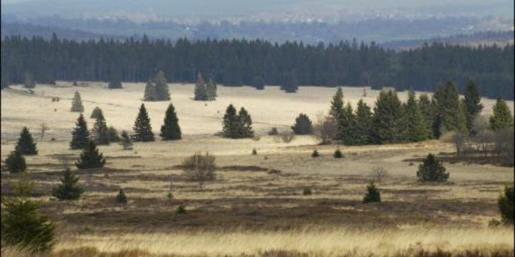
Also further on in Malmedy, you can stop for a drink. You are already in the High Fens.
The Hoge Venen are part of the Hoge Venen-Eifel nature park. The High Fens are located on a plateau, largely in the Ardennes and to a smaller extent in the Eifel. It is located in Wallonia in eastern Belgium and in a piece of neighboring Germany.
At Eupen we leave the Hoge Venen, where you can refuel along the route, again and we continue winding via Sippenaeken to the end point in Slenaken.
Because I have driven this route myself, this route gets 5 stars.
Route details:
rp 5 - Three-country point
rp 11 - Hürtgenwald
rp 14 - Landhotel Kallbach in Simonskall
rp 22 - Burg Hengebach in Heimbach
rp 26 - die Hexenküche in Hallschlag
rp 31 - Raiffeisen Prüm. - Possibility of refueling
rp 36 - On Knoll - Coffee stop in Amel
rp 42 - The Robertville Lake
rp 45 - au p'tit bonheur - coffee stop in Malmedy.
rp 46 - The High Fens
rp 48 - Q8. - Possibility of refueling in Eupen
 Links
Links  Usage
Usage Want to download this route?
You can download the route for free without MyRoute-app account. To do so, open the route and click 'save as'. Want to edit this route?
No problem, start by opening the route. Follow the tutorial and create your personal MyRoute-app account. After registration, your trial starts automatically.  Disclaimer
Use of this GPS route is at your own expense and risk. The route has been carefully composed and checked by a MyRoute-app accredited RouteXpert for use on TomTom, Garmin and MyRoute-app Navigation.
Changes may nevertheless have occurred due to changed circumstances, road diversions or seasonal closures. We therefore recommend checking each route before use.
Preferably use the route track in your navigation system. More information about the use of MyRoute-app can be found on the website under 'Community' or 'Academy'.