04 TAS Port Arthur to Southport

This route was brought to you by:
RouteXpert Hans van de Ven (Mr.MRA)
Last edit: 20-01-2023
 Route Summary
 Tasmania is known for its many national parks, green rugged landscapes and the Tasmanian Devil. Only a few living specimens of the Tasmanian Devil are known. Much of the island is untouched and designated as a national or wildlife park. In addition, one can find many waterfalls in Tasmania. Tasmania's coastline is mountainous with a number of white sand beaches. In the waters around Tasmania you can dive and snorkel to the colorful underwater life. Tasmania has a diversity of flora and fauna; the most diverse types of plants, trees and animals, especially birds and a lot of typical Australian marsupials, which you will not find anywhere else in the world!
You're going to see and experience it all in this 5 star rated amazing tour of Tasmania, a tour that also visits the capital Hobart is one to remember!
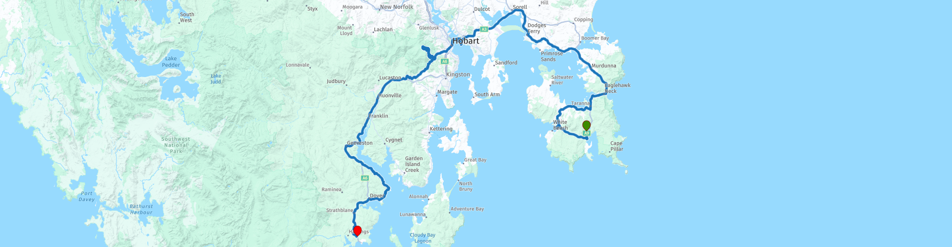
Starting Point: Oakwood, Fox & Hounds Inn
End point: Southport, Southport Hotel & Caravan Park
ATTENTION: DRIVING LEFT!
 Share this route


Animation

Verdict


Duration
8h 1m

Mode of travel
Car or motorcycle

Distance
257.47 km

Countries

 RouteXpert Review
 After lunch you head towards the capital Hobart, just before Hobart, 2 more beautiful viewpoints that you should not miss, you have a beautiful view over the Derwent River and Hobart itself. The first point, The Kangaroo Bluff Battery c1885, was built to support the Queens Battery and the Battery Point Battery. It was developed to prevent enemy ships from firing on Hobart Town from just out of range of the Domain and Battery Point batteries.
The second point, Rosny Hill, this is in a beautiful part of Hobart called Rosny. On the eastern bank of the River Derwent, the hill sits on its own small peninsula in Kangaroo Bay. At the top of the hill you will find the viewpoint with a beautiful view of the Derwent River, the Tasman Bridge, Hobart, Ross Bay and the Royal Tasmanian Botanical Gardens. As a plus, the whole scene is surrounded by Mount Wellington looming in the distance. The viewing platform features informative displays so you know exactly what you are looking at in the distance. The whole area is well maintained by the city. They even cut down the tops of trees that try to block the view. Amazing, right!
Via the Tasman Bridge you cross Montagu Bay and arrive in Hobart, the capital, so plenty of choice to make a stop or choose to leave the crowds and drive on to the next viewpoint.
This point is on Mount Wellington, before starting the climb, or on the way down, you could stop at "The Springs" for coffee or lunch.
After the stop, you wind for a while via a winding track to the Huon Highway, this is an 87 kilometer long highway. The highway forms part of the A6 and connects Hobart to the southern parts of Tasmania. You continue to follow this until "Surges Bay", because here you continue to follow the coastline to "Dover", where you first stop to refuel. Then via the highway the last 15 KM to the terminus in Southport. Where you can let the impressions of the day pass again in the evening.
Information Tasmania
Tasmania was connected to the Australian mainland for most of the past 100,000 years. As a result, it was probably populated quite soon after the arrival of the first explorers in Australia. The first Australians may have arrived on the continent as early as 60,000 years ago. Tasmanians looked like dark Africans. They were quite large: the men averaged 5'6" to 5'7", but some were up to 2' tall. The oldest archaeological sites on the island are Warreen Cave, estimated to be 34,790 years old, and Parmerpar Meethaneer Cave, which is between 44,200 and 34,000 years old. The stone tools of the Tasmanians were quite primitive compared to those of other modern humans. The island became separated from the mainland again about 8,000 years ago. Subsequently, this underwent considerable development, while in Tasmania some techniques, such as those of tools with handles, were even lost. The Tasmanians lived as hunters and gatherers. They numbered, according to estimates, between 3,000 and 10,000 people. There were several tribes that regularly fought among themselves. The Tasmanians, like people elsewhere, made art, including rock art.
The governor of the Dutch East Indies, Antonie van Diemen, commissioned Abel Tasman on a voyage of discovery to mainland Australia. On his journey, Tasman discovered the island that was later named after him on November 24, 1642. He named it after his client: Van Diemensland. At the end of the 18th century, the English colonized the island and took English and Irish deportees there. After these deportations from England were stopped, the Vandiemenslanders changed the name of the island to 'Tasmania' on January 1, 1856, after its Dutch discoverer. The capital Hobart is, after Sydney, the oldest city in Australia. In 1803, the English governor, John Bowen, declared martial law. The original Tasmanians (Aboriginals) were almost completely wiped out until 1830. There are no direct descendants of Tasmanians left, only people who are descended from female Tasmanians and Europeans. The last full-blooded Tasmanian, Trucanini, died in May 1876. Although the island is the smallest state, there are approximately 500 self-contained protected areas, totaling 40% of Tasmania's land area. For example, the Styx Valley is threatened by logging companies and many other nature areas that are not protected are also threatened with total destruction. Nevertheless, the Tasmanian wilderness is a World Heritage Site in terms of nature and culture.
There are two types of predatory marsupials in Tasmania. For example, the island is the only place where the Tasmanian devil still roams, a 60 cm long, carnivorous and black and white colored marsupial, known for its great voracity and ferocity. Since the late 20th century, the number of Tasmanian devils has been visibly declining. This is the result of, among other things, a tumor disease. Another predatory marsupial mainly found in Tasmania is the spotted marsupial, a marsupial averaging 35 cm in length with a white-spotted, light brown color. Until the early 1930s, Tasmania was also the only area where the marsupial wolf (or Tasmanian tiger) still lived, but the last specimen of this predatory marsupial animal died in 1936 at Hobart Zoo. Tasmania is home to a number of other animals that are not (or no longer) found anywhere else. The Pseudomys higginsi is an approximately 13 cm large rodent, which mainly lives in the higher forests. The red-bellied pademelon is a brownish kangaroo about 60 cm high that only jumps around in Tasmania. The Tasmanian bristle-tailed kangaroo rat is a 12-inch (30 cm) long, brownish-gray kangaroo rat that lives only in Tasmania and moves at night and on the ground.
The Tasmanians were the indigenous people of the Australian state of Tasmania. Today, however, they are considered extinct as there are no full-blooded Tasmanians left. The people disappeared (due to murders and European diseases) in the years after the European colonization of Tasmania. The last full-blooded Tasmanian, a woman named Truganini, died in 1876.
The descendants of the Tasmanians still live in Tasmania, but much of their original culture and language has been lost. However, since the 1970s, attempts have been made to revive this culture.


 Links
Links  Usage
Usage Want to download this route?
You can download the route for free without MyRoute-app account. To do so, open the route and click 'save as'. Want to edit this route?
No problem, start by opening the route. Follow the tutorial and create your personal MyRoute-app account. After registration, your trial starts automatically.  Disclaimer
Use of this GPS route is at your own expense and risk. The route has been carefully composed and checked by a MyRoute-app accredited RouteXpert for use on TomTom, Garmin and MyRoute-app Navigation.
Changes may nevertheless have occurred due to changed circumstances, road diversions or seasonal closures. We therefore recommend checking each route before use.
Preferably use the route track in your navigation system. More information about the use of MyRoute-app can be found on the website under 'Community' or 'Academy'.