Koenigsfeld im Schwarzwald Ochsengarten

This route was brought to you by:
RouteXpert René Plücken (MRA Master)
Last edit: 12-02-2021
 Route Summary
  Share this route


Animation

Verdict


Duration
6h 20m

Mode of travel
Car or motorcycle

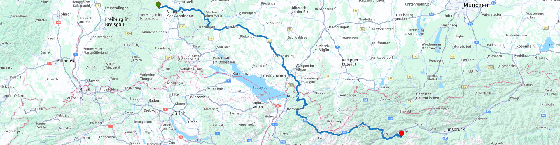
Distance
352.90 km

Countries


 RouteXpert Review
 Now we really go up and ride over various passes, such as Schnepfegg, Hochtannbergpass and the Hanthennjoch (RP10) which is at 1894 meters altitude.
We drive through several beautiful areas such as Schwarzwald, Schwaben and Allgäu. Here you have beautiful winding roads with beautiful views, but also small field and forest roads. On the B200 Begrenzewaldstraße from Schoppernau to Warth you drive along the river and you also drive through several semi-open tunnels which is a particularly beautiful sight.
Warning there are also many ascents, descents and very narrow roads with hairpin bends, so driving experience is desirable.
The area differs from meadow, forest and mountain areas, along the way you also drive through pretty little villages and towns, so there are also plenty of opportunities to stop for a short break or to visit.
On the last part of the route, the cows and horses roam free and therefore also come on the road, so watch out and watch your speed.
We had to change part of the route due to roadworks and closures, so we ended up at almost 380km at the end of the day, but it was also a beautiful ride via the alternative route.
We spend the night in Hotel Gasthof Walderhof in Ochsengarten, a beautiful little village on a small stream, where horses and cows walk the streets in the evenings.
This route gets 5 stars, because of the beautiful roads and beautiful nature.


 Links
Links  Usage
Usage Want to download this route?
You can download the route for free without MyRoute-app account. To do so, open the route and click 'save as'. Want to edit this route?
No problem, start by opening the route. Follow the tutorial and create your personal MyRoute-app account. After registration, your trial starts automatically.  Disclaimer
Use of this GPS route is at your own expense and risk. The route has been carefully composed and checked by a MyRoute-app accredited RouteXpert for use on TomTom, Garmin and MyRoute-app Navigation.
Changes may nevertheless have occurred due to changed circumstances, road diversions or seasonal closures. We therefore recommend checking each route before use.
Preferably use the route track in your navigation system. More information about the use of MyRoute-app can be found on the website under 'Community' or 'Academy'.