D Obersteinebach Valwiger Berg Treis Karden Obersteinebach 220 km

This route was brought to you by:
RouteXpert Johan Baars (RouteXpert)
Last edit: 26-11-2019
 Route Summary
  Share this route


Animation

Verdict


Duration
5h 6m

Mode of travel
Car or motorcycle

Distance
220.82 km

Countries

 RouteXpert Review
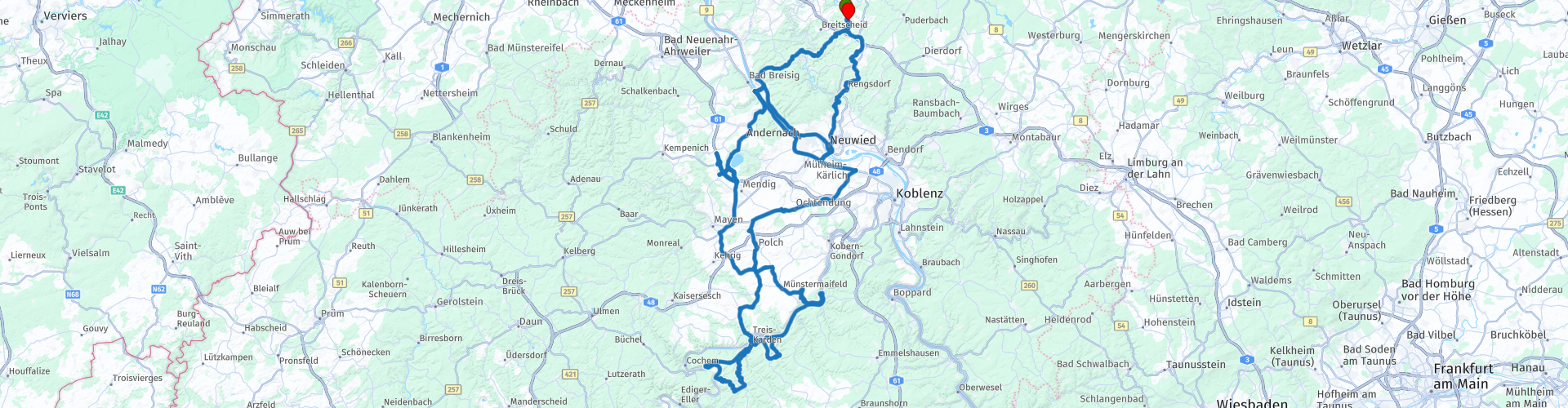
 After we have crossed the Rhein we go towards our next highlight. We have a coffee stop planned at Maria Laach known for his Abdei. This Abdei who always attracts many visitors is located on the Aacher See a natural lake in the Vulkaneifel as there are so many.
After the coffee stop, we continue our trip from today to Brodenbach ad Mosel with its world-famous and often visited Ehrenburg. We continue our way along the Mosel towards Treis-Karden. We are now 2 hours on tour and a lunch address arrives shortly before Treis-Karden. On the right side of the road is the Moselwehr where a fish smokehouse is located. You can eat a delicious smoked eel or trout as lunch here.
We turn on the road for a moment, a little further on, turn right towards Lütz. This town is known by the moto lover people for the hotel Sonnenblick. Who does not know it. We drive towards the top and go down again on the other side and drive towards Treis-Karden. We drive towards the Valwigerberg, according to some the most beautiful environment with a succession of fantastic views from above on the Moselle. We turn back towards Brutig-Frankel and then on to Treis-Karden and cross the Moselle to Karden. We drive towards the Rhein and cross the river at Neuwied. Then we drive back through Naturpark Rhein Westerwald back to Obersteinebach and our Hotel Heiderhof.


 Usage
Usage Want to download this route?
You can download the route for free without MyRoute-app account. To do so, open the route and click 'save as'. Want to edit this route?
No problem, start by opening the route. Follow the tutorial and create your personal MyRoute-app account. After registration, your trial starts automatically.  Disclaimer
Use of this GPS route is at your own expense and risk. The route has been carefully composed and checked by a MyRoute-app accredited RouteXpert for use on TomTom, Garmin and MyRoute-app Navigation.
Changes may nevertheless have occurred due to changed circumstances, road diversions or seasonal closures. We therefore recommend checking each route before use.
Preferably use the route track in your navigation system. More information about the use of MyRoute-app can be found on the website under 'Community' or 'Academy'.