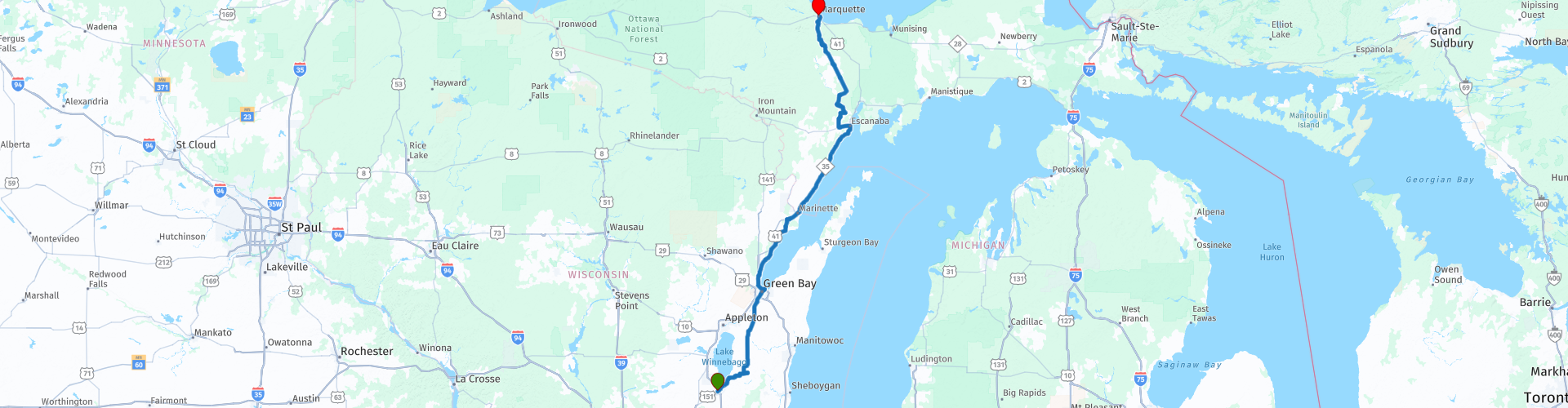
Fond du Lac to Marquette on Lake Superior via Green Bay and Menominee

This route was brought to you by:
RouteXpert Nick Carthew - (MRA Master)
Last edit: 29-10-2021
 Route Summary
 This route travels first through vast areas of open farmland, then it follows the western shore of Green Bay (Lake Michigan) for over 90 miles (145 km) before heading north through the Gwinn State Forest Area to the shore of Lake Superior. The roads are laid back and relaxing with some great scenery which is why I have awarded 4**** stars.
 Share this route


Animation

Verdict


Duration
6h 45m

Mode of travel
Car or motorcycle

Distance
424.90 km

Countries

 RouteXpert Review
 This route starts with a visit to Lake Winnebago and like many of the other lakes on this tour, it is heavily used for recreation all year round. At 137,700 acres it is the largest lake entirely within the state of Wisconsin. The walleye fishing on Lake Winnebago is widely thought to be some of the best in the country. Anglers come from miles around to try their hand at Winnebago’s jumbo perch.
Leaving the lake and fishermen behind The route heads into the vast open farmlands on arrow straight roads. The roads aren't thrilling, but that gives you a chance to kick back, relax and enjoy the scenery. A coffee stop at Scotty's Bar and Grill is scheduled at RP 16. Scotty is 'one of those characters' that collects all sorts of weird and wonderful things and then adorns his cafe with them!
An hour later and you'll be following the Fox River to arrive in the city of Green Bay.
Green Bay is Wisconsin's oldest settlement. The very first visitors to Greater Green Bay were successful entrepreneurs. From beaver pelts for European hat makers in the 1600s, to the invention of the world's first splinter-free toilet paper in the early 1900s. Blessed with an abundance of natural resources, Green Bay was, and continues to be, a major shipping center. The city's largest employers remain the paper and shipping industries.
Green Bay is a sub-basin of Lake Michigan so this will be your first view of one of the Great Lakes. RP 18 not only takes you to the water's edge, but to Elvis Presley's favourite roller coaster, the Zippin Pippin roller coaster.
The Zippin Pippin is one of the oldest existing wooden roller coasters in the United States. It was initially constructed in the former East End Park in Memphis, Tennessee in 1912 and then bought by the city of Green Bay in 2010 and now sits on the shore of Lake Michigan. The Zippin Pippin was Elvis Presley’s favorite roller coaster back when it was located at Libertyland Amusement Park in Memphis, Tennessee. On several occasions, he would buy out the park and host a private party for friends and family. The last time Elvis rode the Zippin Pippin was on August 8, 1977, just eight days before his death. At that time, it’s said he lost a belt buckle! You could pay for your trip if you found that!
The route now follows the western shore of Green Bay (Lake Michigan) for two hours. It's a route of two halfs really, for the half you'll be a mile or so inland, occasionally coming back to the lake for a quick glimpse. You will then cross the state line between Wisconsin and Michigan and arrive at Menominee.
Menominee is a city with a population of about 8,500. In historic times, this area was the traditional territory of the Menominee Indian Tribe. The town of Menominee was named after their English name which roughly translates as "wild rice," a nickname given to them by their Ojibwe neighbours based on their cultivation of wild rice as a staple food. They were removed to west of the Mississippi River and now have a reservation along the Wolf River in North Central Wisconsin after ceding their territory to the United States in the 1836 Treaty of the Cedars. This is a passage from The Menominee Indian Tribe of Wisconsin web page:
Posoh Mawanew Weyak (Hello Everyone)
Welcome to the Menominee Indian Tribe of Wisconsin. The Menominee Tribe's history is unique because our origin or creation begins at the mouth of the Menominee River, a mere 60 miles east of our present Menominee Indian Reservation. This is where our five clans: ancestral Bear, Eagle, Wolf, Moose, and Crane were created. Not many tribes in this region can attest to the fact their origin place exists close or near to their present reservation.
Menominee is a great place to stop for lunch, i have added POIs for some fast food restaurants and a fuel stop, There are many more restaurants to choose from a little further on in Menominee.
The second half is completely different, using State Highway M35 you will travel a lot closer to the lake edge, sometimes right alongside it. It's another chance to kick back, relax and enjoy the great scenery.
You'll say goodbye to the lake at RP 35 as you turn off and head back inland. The open agricultural landscape slowly changes to one of forestry as you head north. There is another coffee stop at RP 40, leaving about an hour left to ride.
RP 44 is at the K. I. Sawyer International Airport, this used to be a U.S. Air Force Base and they have several military planes on display on the roadside. 30 minutes later and you'll be on the shore of Great Lake number 2; Lake Superior in the city of Marquette.
Named after Father Jacques Marquette, the town was founded in the mid-1800's and was an important Lake Superior shipping port for the iron mining industry. You can see the ore dock used for loading ships at RP 48.
Marquette has been named one of the Dozen Distinctive Destinations in the United States by the National Trust for Historic Preservation. It's a beautiful city and I would advise 2 nights here allowing you to enjoy awesome views of Lake Superior, historic neighborhoods, the delightful downtown area, and great art galleries.
The route ends at the Value Host Motor Inn and I have included a link for this below.


 Links
Links  Usage
Usage Want to download this route?
You can download the route for free without MyRoute-app account. To do so, open the route and click 'save as'. Want to edit this route?
No problem, start by opening the route. Follow the tutorial and create your personal MyRoute-app account. After registration, your trial starts automatically.  Disclaimer
Use of this GPS route is at your own expense and risk. The route has been carefully composed and checked by a MyRoute-app accredited RouteXpert for use on TomTom, Garmin and MyRoute-app Navigation.
Changes may nevertheless have occurred due to changed circumstances, road diversions or seasonal closures. We therefore recommend checking each route before use.
Preferably use the route track in your navigation system. More information about the use of MyRoute-app can be found on the website under 'Community' or 'Academy'.